
Forest Safari
Beyond Mannavanur: Into the Protected Forest
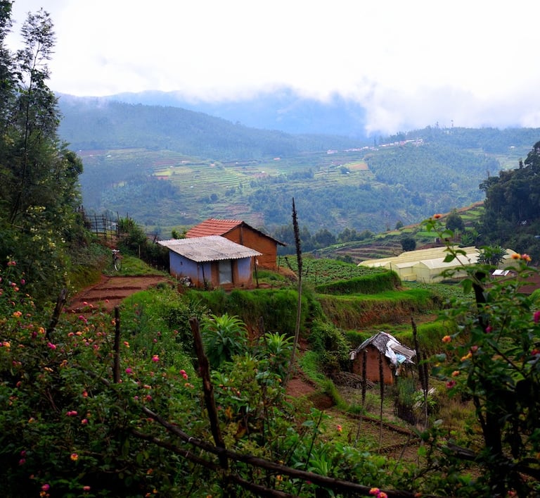
Most visitors assume Berijam Lake is a Kodaikanal attraction — something you access from town, permit in hand, after a 45-minute drive through pine forest. What very few people know is that Berijam Lake can also be reached directly from Mannavanur village through a second, entirely different route — one that takes you through the densest and most untouched section of the entire forest.
There are two routes to Berijam Lake. The first starts from Kodaikanal Lake, heads toward Moir Point and continues into the reserve forest. Along this road sit three of the most dramatic viewpoints in the Palani Hills — Silent Valley View, Berijam Lake View and Cap's Fly Valley View — each offering sweeping panoramas across the forest canopy. This is the route most tourists take and the one served by the DFO permit and organised van safaris.
The second route starts from Mannavanur village itself and leads directly to Berijam Lake through the heart of the forest. There are no famous viewpoints on this road. What it offers instead is something rarer — the full density and wilderness of the Palani Hills reserve forest, experienced from the inside. For anyone staying in Mannavanur, this means Berijam Lake is not a day trip to Kodaikanal. It is your own backyard.
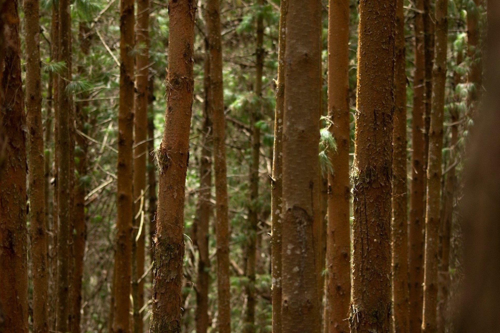
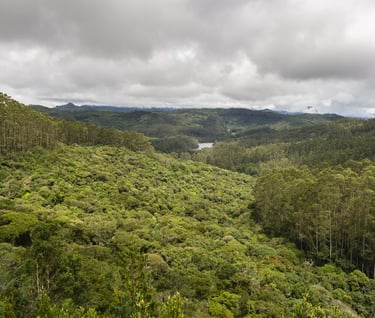
The Kodaikanal Forest Van Safari takes you into the protected reserve forests of the Upper Palani Hills, through shola ecosystems that have survived largely undisturbed for centuries, and eventually to Berijam Lake — a pristine highland reservoir so well-protected that it still supplies drinking water to the town of Periyakulam in the valley below. And beneath the forest road runs a story that almost no visitor knows. The route to Berijam Lake was once called The Escape Road — upgraded in 1942 by the British as a wartime evacuation route in case the Japanese invaded India. It is history buried quietly in the forest, waiting to be found.
The Forest Van Safari: What It Is and How It Works
The Kodaikanal Forest Van Safari is a permit-controlled journey managed by the Tamil Nadu Forest Department. It allows a strictly limited number of vehicles each day to travel into the Upper Palani Reserve Forest — passing through shola forest corridors, across high-altitude grasslands and viewpoints, and arriving finally at Berijam Lake, deep inside the protected zone.
Full Trip (to Mannavanur Lake and beyond)
₹250 to ₹300 per person | Duration: 4 to 5 hours
This longer route takes you deeper into the highland forest, covering more of the forest road and giving you more time in the protected zone.
Half Trip (to Berijam Lake)
₹200 per person | Duration: 2 to 3 hours
The more focused option — directly to Berijam Lake and back. Ideal if you have half a day and want the lake experience without the extended drive.
Vans depart at 9:00 AM. Tuesday is a holiday — no safari operates on Tuesdays.
For private vehicles, the DFO (District Forest Officer) entry ticket fee is: Car: ₹200 | Van: ₹300, DFO ticket window: 7:30 AM to 9:30 AM, Checkpost entry window: 9:00 AM to 12:00 PM (noon). To book an organised van safari, contact: Western Mount Cab Booking: 87540 69339
The word "safari" can create expectations of open jeeps and dramatic wildlife encounters — that is not what this is. The safari here is a controlled forest drive along a designated route, with entry and exit regulated by the Forest Department at multiple checkpoints. What makes it distinctive is precisely that control. The forest road stays quiet, unhurried and genuinely wild because the number of vehicles is kept firmly in check.
The route passes near the Mathikettan Shola forest region on the Tamil Nadu-Kerala border before reaching Berijam Lake, approximately 21 to 23 kilometres from Kodaikanal town. The full round trip, including time at the lake and stops along the forest road, takes between two and five hours depending on the option chosen.
Mathikettan Shola: The Forest That Confuses the Mind
The name says everything about the experience. Mathikettan derives from the Tamil phrase meaning "one whose mind has been confused" — a name given to this forest because, once you enter it, the paths twist and the canopy closes over and the outside world disappears entirely. Even those who know these hills well have described the disorienting quality of deep shola forest. It is simultaneously immersive and unsettling in the best possible way.
What is a Shola Forest?
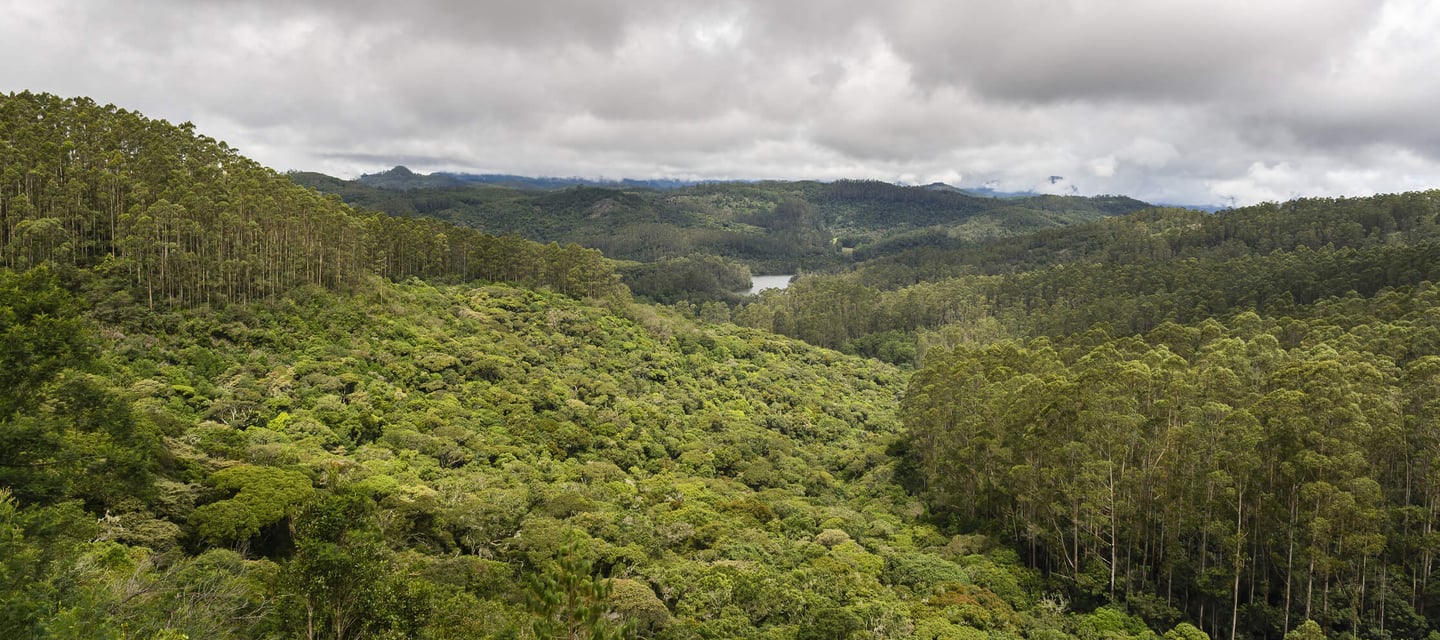
The word shola refers to a specific type of high-altitude forest ecosystem found only in the Western Ghats. Shola forests grow in the hollows and valleys between open highland grasslands, sheltering from wind and frost in the natural dips of the terrain. They are dense, dark, evergreen and extraordinarily rich in species — yet they cover only a fraction of the total landscape area.
In a healthy shola-grassland ecosystem, the two habitats exist side by side. Open grasslands drain rainfall efficiently and channel it into the hollows where the sholas absorb and hold it, releasing water gradually into streams and rivers that flow down to the plains. The Palani Hills sholas are the source of rivers that supply drinking water and irrigation to large areas of Tamil Nadu. When a shola is lost — cleared for plantation or encroachment — the hydrological function collapses with it. These forests are not just beautiful. They are functional water infrastructure for the entire region below.
Mathikettan Shola as a Protected Zone
Mathikettan Shola National Park straddles the Tamil Nadu-Kerala border and was first notified as a Reserve Forest by the Travancore Government in 1897. It was declared a full National Park on 21 November 2003, covering 12.82 square kilometres. The surrounding area was subsequently designated an eco-sensitive zone by the central government to buffer the park against development pressure. The park forms part of the Western Ghats landscape recognised as a UNESCO World Heritage Site.
Wildlife of the Shola
The forest along the safari route and within the Mathikettan zone supports a remarkable range of species for a relatively compact protected area.
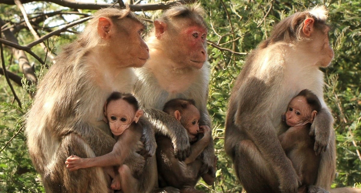
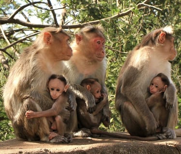
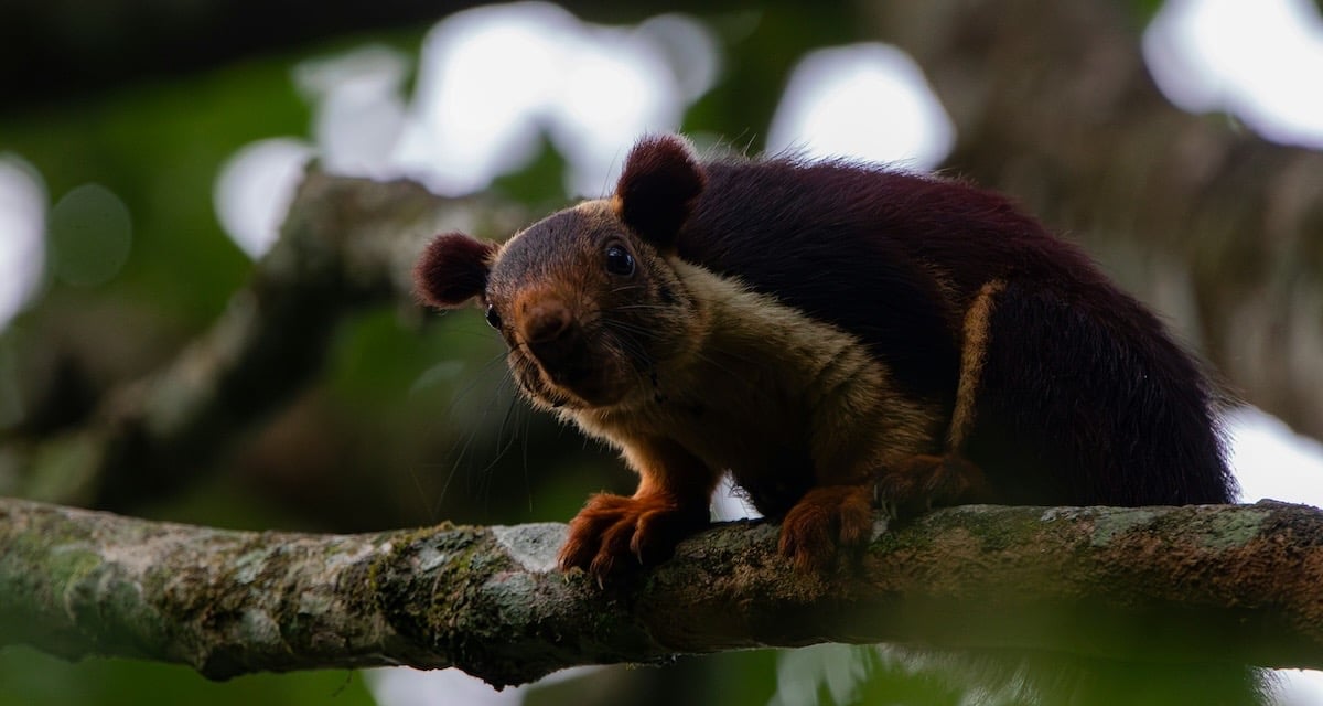
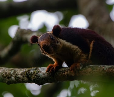
Mammals you may encounter along the forest road or in the shola margins include Indian gaur (bison), sambar deer, spotted deer, Nilgiri langur, lion-tailed macaque, wild boar, Malabar giant squirrel and, occasionally, Indian elephant. Elephants from the Munnar division move through this landscape seasonally, making it an active corridor between protected areas on both sides of the state border. Leopards are present but almost never seen.
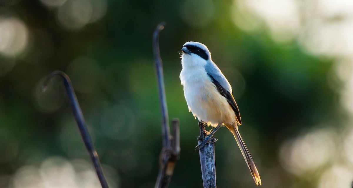
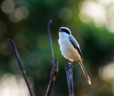
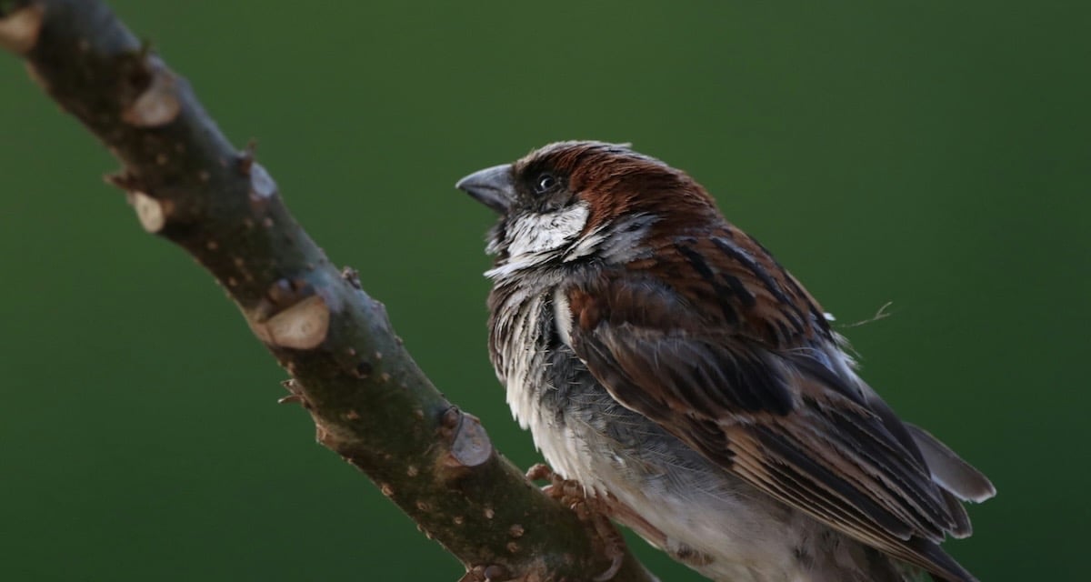
Birds are where the shola really shows its richness. Species recorded in and around the Mathikettan zone include the grey-breasted laughing thrush, white-bellied shortwing, Nilgiri flycatcher, Kerala laughing thrush, crested serpent eagle, Nilgiri wood pigeon, pale-rumped swallow, gem-flecked woodpecker and Malabar whitethroat. For a dedicated birdwatcher, a morning on this forest road can be extraordinarily rewarding.
The forest also supports a high diversity of butterflies and endemic insects, along with rare orchids, medicinal herbs and the twisted, moss-covered trees characteristic of mature shola vegetation. Three streams — Uchillkuthi Puzha, Mathikettan Puzha and Njandar — originate within the forest and flow as tributaries of the Panniyar river system.
What to Expect as You Drive Through
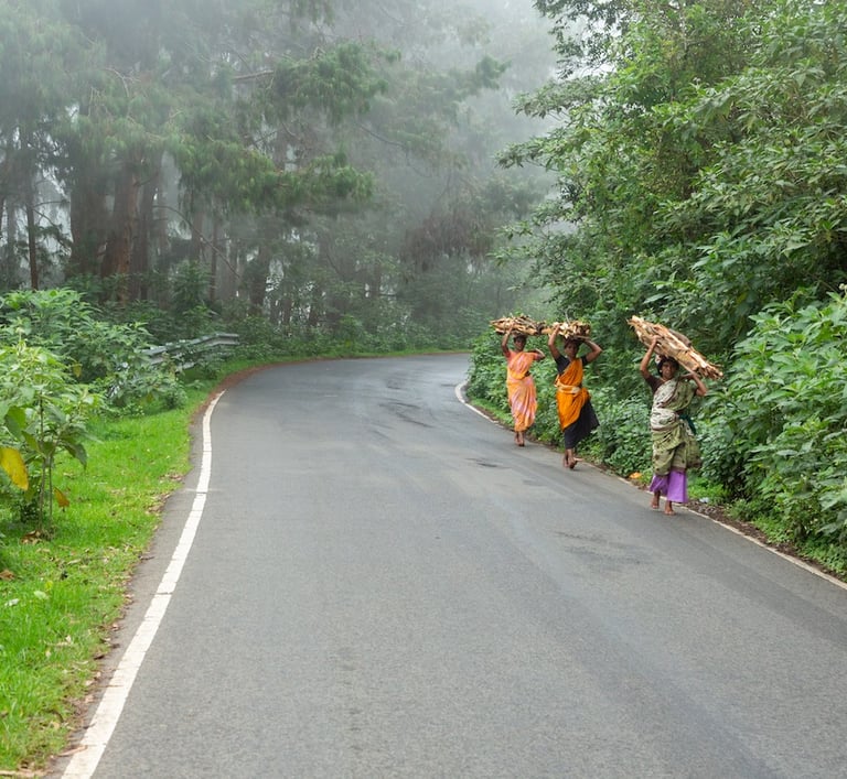
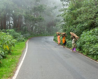
The forest road does not offer a single dramatic arrival. The experience builds gradually. Plantations of eucalyptus and pine give way to denser, darker, more complex forest. The canopy closes overhead. The temperature drops noticeably. The light shifts from open highland brightness to something filtered and green. Bird calls replace road noise. Mist moves unpredictably — sometimes sitting thick on the road ahead, sometimes clearing briefly to reveal a long valley view before closing in again. This is forest travel at its most honest. There is nothing to do except pay attention. That, for most visitors who make it here, turns out to be more than enough.
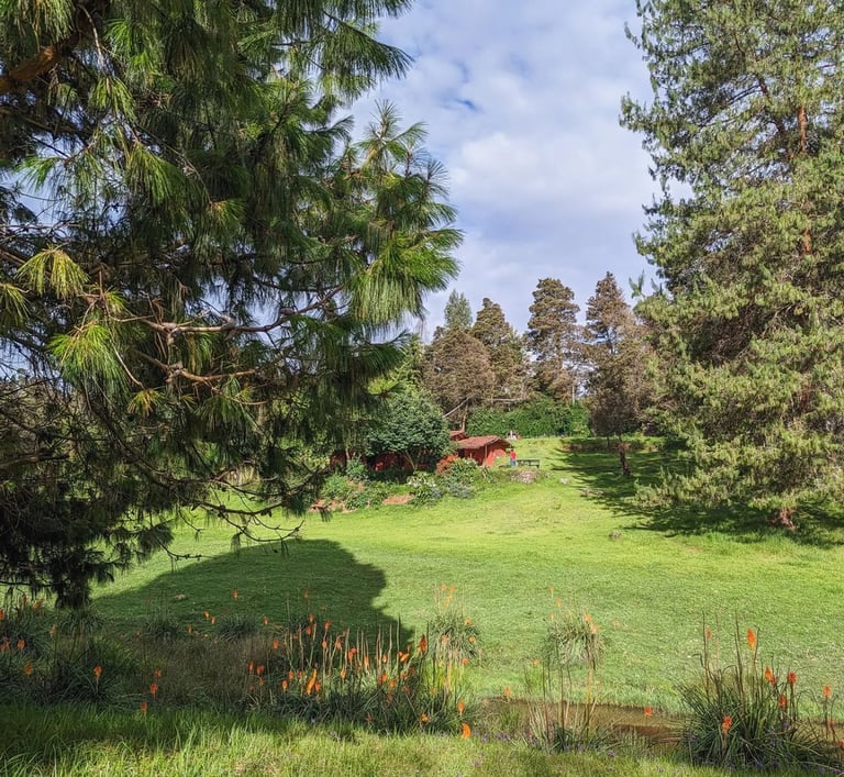
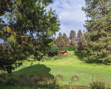
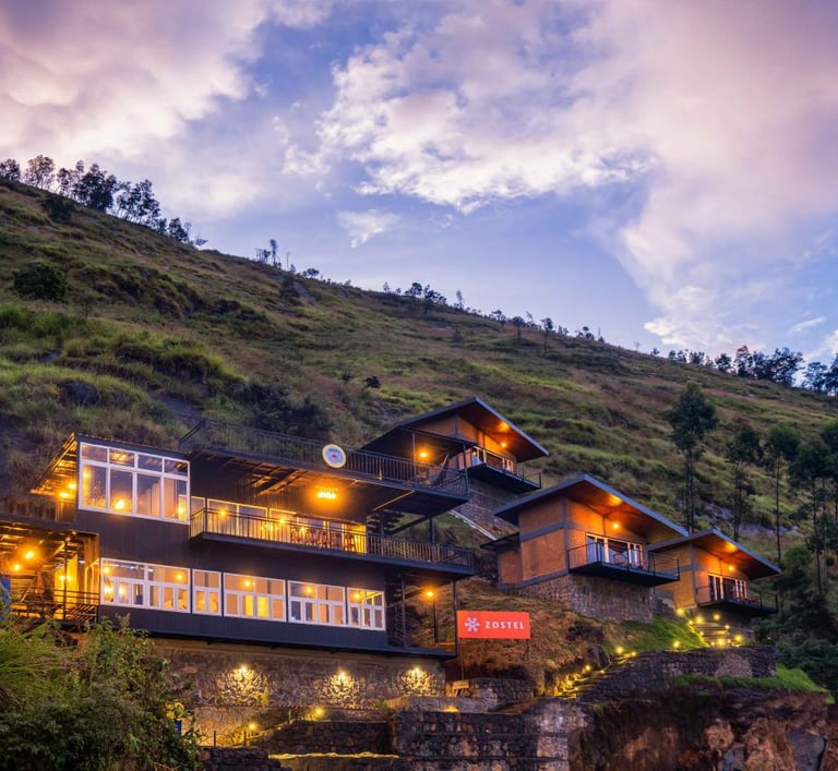
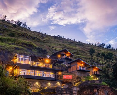
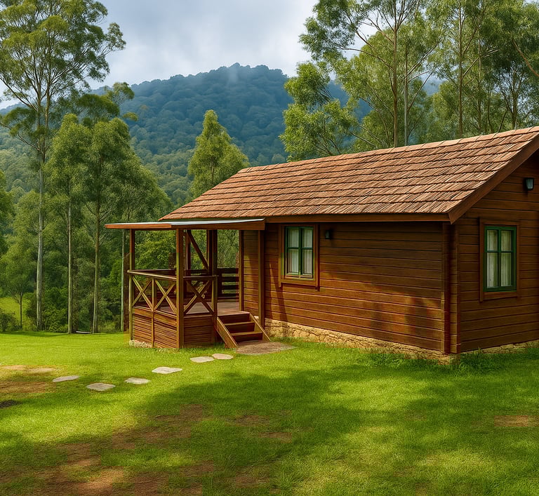
Where to Stay Near Mannavanur
Mannavanur is small and accommodation options are limited. This is part of its appeal, the village has not been overtaken by the hotel industry that crowds other hill stations. Plan your stay carefully and book ahead during the October to January peak period. Learn more.
Berijam Lake: Kodaikanal's Most Protected Water
Berijam Lake was created in 1867 when a dam was built across the Berijam Canal to serve as a reliable water source for Periyakulam, the town in the valley below the Palani Hills. The area around the original dam was swampy grassland that gradually transformed into a lake ecosystem over the following decades. Today the lake covers approximately 59 acres and its water remains clean enough to supply Periyakulam directly with drinking water — which is precisely why its protection is so seriously enforced and why boating, once permitted, has now been permanently banned to prevent contamination.
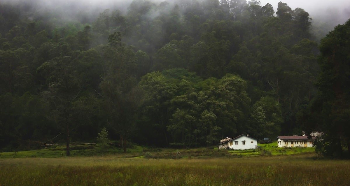
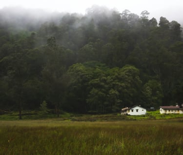
The lake sits at the old site of Fort Hamilton in the Upper Palani Hills. On a clear morning the water is perfectly still and the forested ridgelines are reflected in it completely. Fog rolls in from the valley after 1:00 PM most days, which is part of why the Forest Department requires all visitors to exit before 3:00 PM — visibility on the forest road drops quickly and the drive becomes dangerous.
Still standing near the lake is a partially blackened two-storey brick building with the words "Britisher's Transit Camp" painted on it in bright yellow. This is one of several rest camps built every 15 kilometres along the full 230-kilometre Escape Route, placed at intervals so that soldiers and evacuees could stop and rest on the long journey from Kodaikanal to Kochi. Most of the other transit camps along the route have since been demolished or fallen into complete ruin. The one at Berijam survives — a tangible remnant of a wartime plan that was never needed but never forgotten.
What You Can Do at Berijam Lake
Swimming and boating are not permitted. What you can do is walk, observe, photograph and be present in a place that most of Kodaikanal's daily visitors never reach.
Birdwatching at the lake margin and along the forest edge is excellent. Serpent eagles are regularly seen perched above the water. Rosefinch, leaf warblers and pale-rumped swallows have all been recorded here. Early arrival and quiet movement along the shoreline produce the best results. The grasslands and forest edge around the lake are where gaur, deer and Nilgiri langur are most often spotted. Dawn and the hour before dusk are peak activity periods, but since the permit system requires exit before 3:00 PM, arriving as early as your permit allows gives you the widest window.
Benches line the lakeside for sitting and absorbing the landscape. The atmosphere is genuinely calm — no hawkers, no commercial stalls, no boat traffic, no music. Just the water, the forest, the birds and the hills. Fishing is permitted with a separate licence from the Fisheries Department.

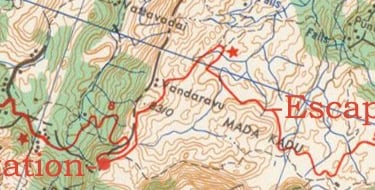
The Secret History Beneath Your Wheels: The 1942 Escape Road
Most visitors to Berijam Lake come for the wildlife and the scenery. Very few know that the road they are travelling has a wartime history that stretches back over eighty years — to a moment when the British administration of India was making serious preparations for the possibility of enemy invasion. In April 1942, Japanese aircraft bombed Madras (now Chennai). The physical damage was limited, but the public response was enormous. The city was evacuated as residents feared a sustained bombing campaign and — more alarmingly — a full land invasion. The situation in the wider war was dire. Singapore had fallen to the Japanese in February 1942. Burma was under assault. The eastern coast of India felt suddenly and genuinely exposed in a way it never had before.
The British authorities in India began contingency planning for the worst case: a Japanese advance westward through the subcontinent. One of the priorities was identifying evacuation routes that could move large numbers of people from the vulnerable coastal cities to the relative safety of the highlands, and then onward to ports where ships could take them out of India entirely. The route identified for the south ran from Berijam Lake, along the southern crest of the Palani Hills, all the way to Top Station on the Kerala border — a high-altitude path that would keep evacuees above the vulnerable valleys for as long as possible. From Top Station the route descended to Munnar and then continued down to Cochin (now Kochi), where ships would be waiting.
The road itself was not new. A dirt track from Berijam Lake to Top Station had existed since 1925, originally created to connect Kodaikanal to the tea country of Munnar and eventually to the port of Cochin — a total distance of approximately 257 kilometres from Berijam to Kochi, a journey that took around eleven hours even in good conditions. In 1942, the British Civil Engineering Department upgraded and reinforced this existing track to make it suitable for military vehicles. Transit camps were built at 15-kilometre intervals along the full 230-kilometre route so that soldiers and evacuees could rest. The road was given an unambiguous name: The Escape Road.
The full planned evacuation route: Detailed map link here.
Berijam Lake → southern crest of the Palani Hills → Top Station →Munnar → Cochin → evacuation by sea.
The Japanese invasion never came. The Allied position in Asia gradually stabilised through 1943 and the threat to mainland India receded. The Escape Road was never used for its intended purpose. But it survived. The road remained operative as a functional inter-state route for nearly five decades after the war ended. It was in use until 1990, when it fell into a dispute between the Tamil Nadu Forest Department and the Kerala Highways Department over which state was responsible for its ownership and maintenance. Neither authority accepted responsibility. Without anyone to maintain it, the road was simply left alone — and the forest, as it always does, began to take it back.
Today, sections of the old Escape Road still exist within the forest zone that the safari route passes through. Driving or walking here, it is worth a moment's thought about what the people who upgraded and reinforced this road were preparing for — and how different the history of these hills, and of South India, might have looked had the fears of 1942 been realised. This story is almost entirely absent from mainstream Kodaikanal travel guides. It is one of the details that makes the Berijam forest drive something more than a pleasant day out. You are travelling a road that was built in urgency and fear — and that an unresolved bureaucratic dispute quietly returned to the jungle.
How to Visit: Permits, Fees and Entry Rules
There are two ways to visit Berijam Lake: by joining an organised van safari, or by driving your own vehicle with a DFO permit.
Option A — Organised Van Safari (Recommended for most visitors)
The simplest and most convenient option. Authorised vans depart from Kodaikanal at 9:00 AM and cover the forest route with a driver who knows the road and checkpoints. No permit arrangements needed on your side.
Half Trip (Berijam Lake): ₹200 per person | 2–3 hours
Full Trip (extended route): ₹250–₹300 per person | 4–5 hours
Departure time: 9:00 AM
Day off: Tuesday — no safari operates
To book: Western Mount Cab Booking — 87540 69339
DFO Office location: here Moir Point checkpost: here
Documents required:
• Valid government-issued ID (Aadhaar, passport, driving licence)
• Vehicle registration documents
• Driving licence
• Valid Pollution Under Control (PUC) certificate — forest officials check this before permitting entry; an expired PUC means no entry
• Cash — digital payment not reliably available at the checkpost
Option B — Private Vehicle with DFO Permit
If you prefer to drive yourself or have hired a private vehicle:
DFO Entry Ticket:
Car: ₹200 | Van: ₹300
Ticket window: 7:30 AM to 9:30 AM at the DFO Office
Checkpost entry: 9:00 AM to 12:00 PM (noon) — no entry after noon
Day off: Tuesday — closed
Rules Inside the Forest Zone:
• Exit by 3:00 PM — no exceptions, no overnight stays permitted
• No smoking within the forest zone
• No alcohol
• Plastic banned — carry reusable bags and bottles
• Do not feed or approach wildlife
• Stay on the designated route only
• Keep voices low in forest sections
• Do not take food out of your vehicle in open hands — monkeys near the lake area will take it.
Places Worth Visiting Near Mannavanur
The scenic villages of Poombarai, Poondi, Polur, Kilavarai surrounds Mannavanur. Learn more.
Two Routes, Two Completely Different Experiences
Berijam Lake can be reached by two routes — and they could not be more different from each other. Understanding both helps you decide which experience suits you, and if you are based in Mannavanur, the choice is even more interesting.
Route 1 — From Kodaikanal via Moir Point (The Viewpoint Route)
This is the route covered by the DFO permit and the organised van safari. It follows the Pillar Rocks Road out of Kodaikanal, passes the Moir Point checkpoint at kilometre 9.3, and continues southwest through the reserve forest to Berijam Lake — a total of 21 to 23 kilometres from town.
What makes this route special is its viewpoints. Three of the finest panoramic spots in the entire Palani Hills sit along this road:
Silent Valley View — an open overlook across an unbroken canopy of forest stretching deep into the valley below. On clear mornings the view reaches the plains of Tamil Nadu far beneath.
Berijam Lake View — the first glimpse of the lake itself, seen from above and at a distance, framed by forested ridgelines. This is where most visitors take their first photograph of the day.
Cap's Fly Valley View — a dramatic drop on one side of the road that opens up into a deep, forested gorge. The name refers to the hats reportedly blown off by the updraught on windy days.
From the Moir Point fork, the road continues 13 kilometres into the forest, passing a fire-watching tower with a fine view of the lake before arriving at the Forest Department camp, eco-education centre and the Britisher's Transit Camp building at Berijam.
Important practical notes for the Mannavanur trek route:
• This is a trekking trail, not a vehicle road — plan accordingly
• A Forest Department trekking permit is required
• A local guide is strongly recommended — the forest trail is not signposted and the terrain can disorient even experienced walkers
• Obtain permits in advance from the DFO Office, Kodaikanal
• Carry sufficient water, food and a first aid kit
• Allow a full day — Outlook Traveller documented this as an overnight experience, with a stay at the Berijam Forest Rest House.
Route 2 — From Mannavanur Village (The Wilderness Trek)
The second route to Berijam Lake starts directly from Mannavanur village — and it is a trek, not a drive. The old forest road that once connected Mannavanur and Kavunji village to Berijam Lake has been reclaimed by the forest over the decades since vehicle access was closed. Today it exists as a trail used by local villagers, trekkers and wildlife researchers. This is what makes it special.
For visitors staying in Mannavanur, this is one of the most extraordinary walks available from your doorstep. You step out of the open grasslands and terraced farms of the village and within a short distance you are inside the densest, most undisturbed section of the Palani Hills reserve forest — the same forest that guards Berijam Lake on all sides.
There are no viewpoint stops, no tea stalls and no other safari vehicles. What the walk offers is something the Kodaikanal route cannot: the full experience of the forest from the inside, at ground level, on foot. Old British-era milestones are still visible along sections of the trail, marking distances to Munnar, Kodaikanal, Madurai and Cochin — ghost signs from the road that time and forest have absorbed.
Wildlife encounters on this trail are well documented. Gaur, elephants, Malabar giant squirrels, wild dogs, deer and a wide range of forest birds have all been reported. Leopard and tiger presence has been recorded in this forest zone, though sightings are extremely rare.
Note
Multiple checkpoints mark your passage on both routes — forest staff note vehicle registrations and times, ensuring no one remains inside the forest after dark. The old Escape Road alignment passes near both routes, unremarked and unmarked. The forest absorbed that story quietly decades ago, and it lies there invisibly alongside the birdsong and the mist.
Berijam Lake from Mannavanur: Closer Than You Think
For visitors based in Mannavanur, Berijam Lake is not a Kodaikanal attraction that requires an early morning drive to town. It is directly accessible from Mannavanur village itself via the second forest route — making it one of the most extraordinary day experiences available from your doorstep.
The Mannavanur trekking route to Berijam takes you through the wilderness heart of the Palani Hills forest — denser, wilder and far less visited than the Kodaikanal approach. There are no viewpoint stops or tea stalls. Instead there is forest: close, dark, immersive and alive with birds and wildlife. Old British milestones still stand along the trail, marking the ghost of the old road. This is what the Palani Hills reserve forest actually looks and feels like from the inside, at walking pace, in silence.
The contrast with Mannavanur itself is what makes this combination so compelling. You step from a landscape of open sheep meadows and terraced farms into one of the most ecologically significant forest reserves in South India — on foot, from your own doorstep. Same hills. Completely different world.
For the organised van safari with viewpoints, drive to Kodaikanal town (60–75 minutes) and reach the DFO office by 8:00 AM. For the Mannavanur trekking route, obtain your permit from the DFO Office in advance and arrange a local guide before setting out.
Suggested itinerary for Mannavanur-based visitors: Two days. Two entirely different landscapes. One base in the highlands.
Day 1 — Mannavanur Lake, ICAR sheep farm, terrace farm walks, fresh produce
Day 2 — Berijam Lake trek via the Mannavanur forest trail with a local guide
When to Go: Seasons and Conditions
October to March — Best Overall
This is the ideal period. Post-monsoon clarity, full lake, active wildlife and excellent birding conditions. Temperatures along the forest road sit between 12°C and 20°C — cool, comfortable and perfect for a day outdoors. December and January are the coldest months; a warm jacket is essential for the early morning drive.
April to June — Acceptable
Pleasant travel conditions and good road surfaces. Slightly drier forest but birding remains productive. Weekday visits are relatively quiet.
Monsoon July to September — Proceed with Caution
The forest turns dramatically green and the lake fills to its brim. However, the approach road can become slippery after heavy rain, visibility along the forest route is frequently very poor, and the Forest Department may restrict or close the route entirely during heavy rain periods. Check conditions locally before travelling in these months.
Timing tip:
Arrive at the DFO office or van booking point by 8:00 AM. Fog thickens over the lake after 1:00 PM and conditions on the road deteriorate by mid-afternoon. Early arrival gives you the best light, the clearest air and the most time at the lake before the mandatory 3:00 PM exit. Day to avoid: Tuesday — the safari does not operate.
Who This Experience Is For
The forest safari to Berijam Lake suits visitors who want nature in an undisturbed state — not a photograph at a famous viewpoint but the sustained experience of moving through a functioning ecosystem that has been deliberately protected from mass tourism.
It is the right choice for birdwatchers, wildlife photographers, trekkers, history enthusiasts and anyone who has found the busy commercial circuit of Kodaikanal town underwhelming and is looking for something genuinely different.
It requires early morning commitment, patience and self-sufficiency. There are no shops, restaurants or facilities inside the forest zone. You carry everything you need. The experience rewards attention rather than activity.
For families, it works well if children are old enough to enjoy observation. The lake area is open enough for supervised movement, and wildlife sightings — which do come with patience — are genuinely exciting for younger visitors.
It may not suit visitors looking for a quick, easily packaged half-day trip or those who prefer comfort-driven experiences with guaranteed attractions at each stop.
Quick Reference — Everything You Need to Know
Van Safari (organised, recommended for most visitors):
• Mannavanur Lake: ₹30 per person entry
• Sheep Farm: ₹20 per adult, free for children
• Coracle ride: ₹100 per person
• Single kayak: ₹250 | Double kayak: ₹400
• Zip-line: ₹500 per person
• Horse riding: ₹100 per round
• Toilets: Small fee applies on site
What to carry:
• Warm jacket (the forest is cooler than Kodaikanal town)
• Food and water (nothing available inside the forest zone)
• Binoculars and camera with zoom lens
• Cash (digital payments unreliable at checkpost)
• Reusable bags and bottles (plastic banned)
• Insect repellent
Private Vehicle — DFO Permit:
Ticket fee: Car ₹200 | Van ₹300
Ticket window: 7:30 AM – 9:30 AM
Checkpost entry: 9:00 AM – 12:00 PM (noon)
Day off: Tuesday
DFO Office location: here
Moir Point checkpost: here
Rules:
• No smoking or alcohol
• No plastic
• No boating on Berijam Lake
• No overnight stays
• Do not feed wildlife
• Stay on the designated route
Location
Berijam Lake
Address
Berijam Lake, Upper Palani Hills, Kodaikanal, Dindigul District, Tamil Nadu 624103
Hours
9am - 3pm